Background
It’s well understood that controlling fallow weeds to preserve moisture and nutrition for the following crop is essential for success. What is less known is that the 10m resolution Sentinel 2 imagery is quite capable of detecting the presence of weeds in fallows. While it may not detect individual plants, clusters of weeds can be identified as they affect the overall reflectance in a pixel, allowing us to map them.
Processing
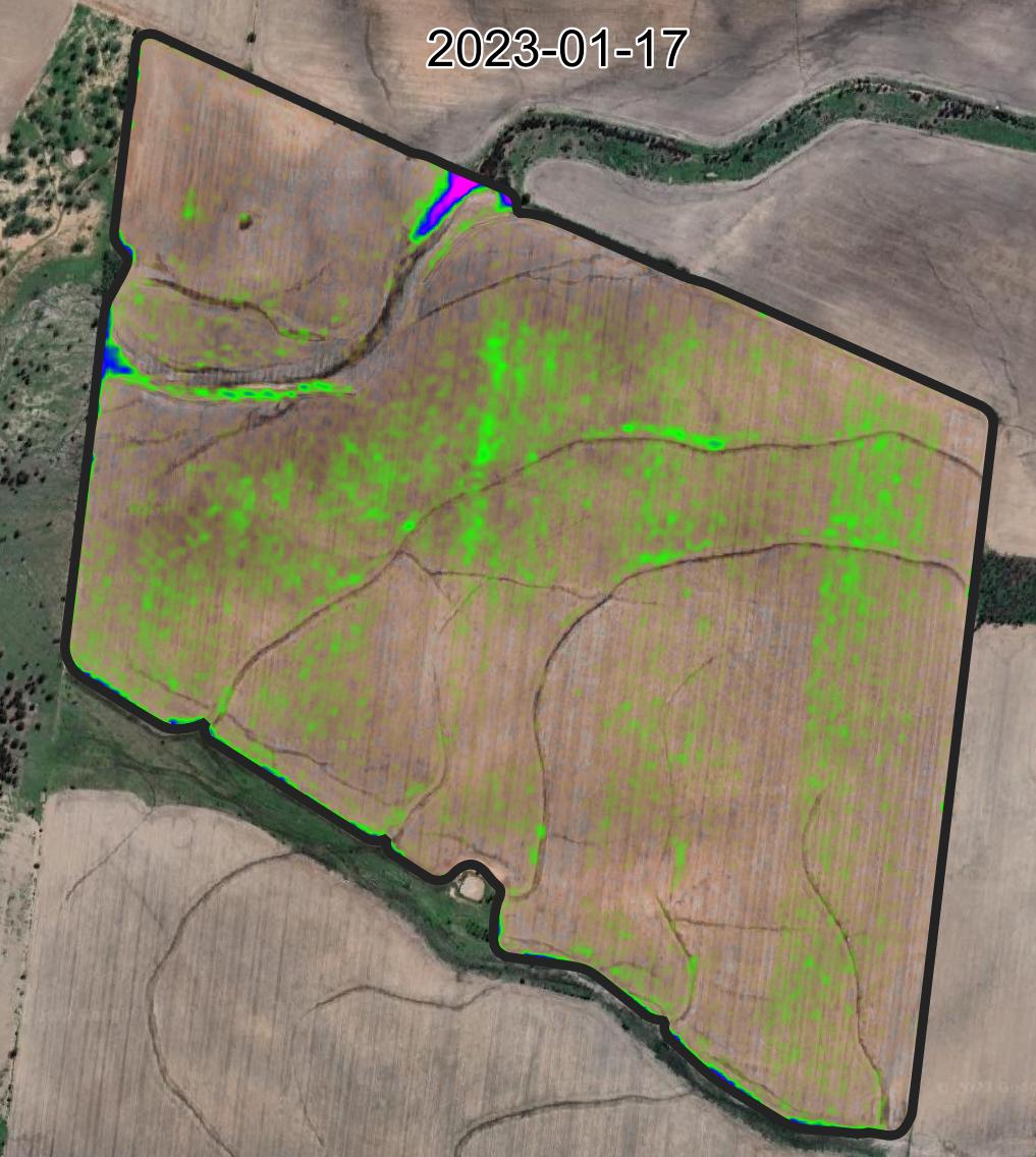
In this example, I have applied the MCARI2 spectral index instead of the usual NDVI. I find MCARI2 does a better job of not saturating and is less affected by soil color, which is advantageous here. The data has been interpolated to smooth out the blocky pixels, making it easier on the eye. The background is a Google Maps high-resolution true color satellite image.
The Story
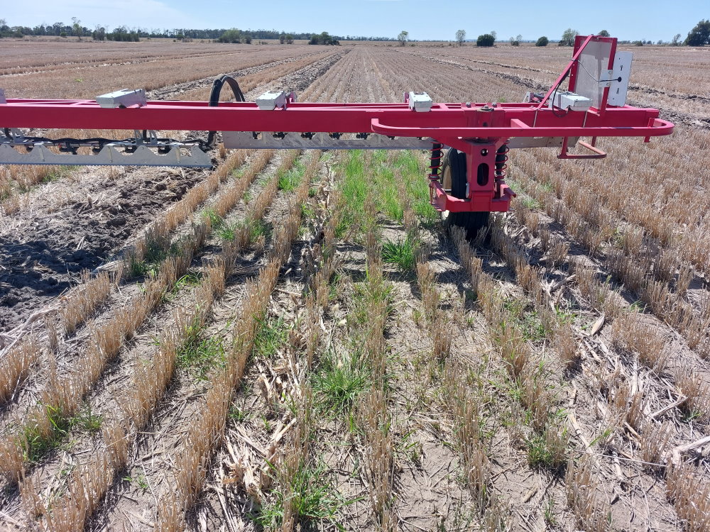
This paddock was sown with wheat in 2022 and harvested in November. Post-harvest, residual herbicides and paraquat were applied, followed by a Weedit camera spray to manage fleabane and other scattered weeds.
After some rain in early January, volunteer wheat germinated in the header trails along with other weeds. You can see interesting patterns across the paddock, with varying amounts of wheat germination in the header trails.
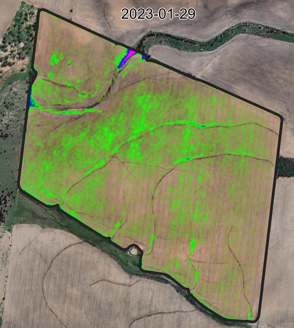
The next image (2023-01-29) shows other parts of the paddock beginning to green up, particularly in heavier soils where the volunteer wheat took longer to establish. In many places, where the wheat grew early, the MCARI2 value decreased as the plants were affected by growing in summer conditions and extending roots beyond the header trail into soil treated with residual herbicides.
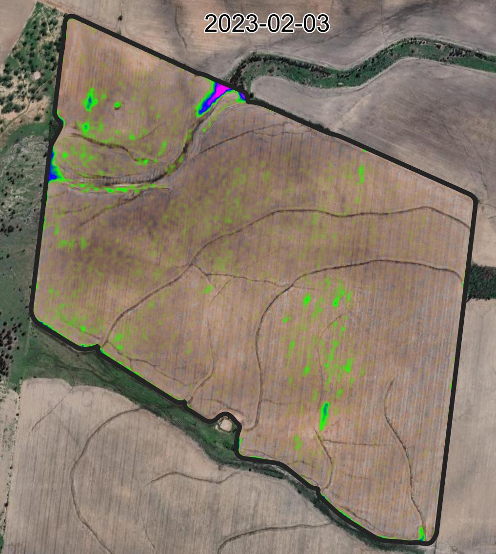
To control the wheat, glyphosate was sprayed on January 27th. The following image (2023-02-03) shows a significant reduction in green, except for a few places. The remaining green indicates glyphosate-resistant populations of barnyard grass and feathertop Rhodes grass. These grasses were also present as individual plants in other areas, too small to be detected in the imagery.
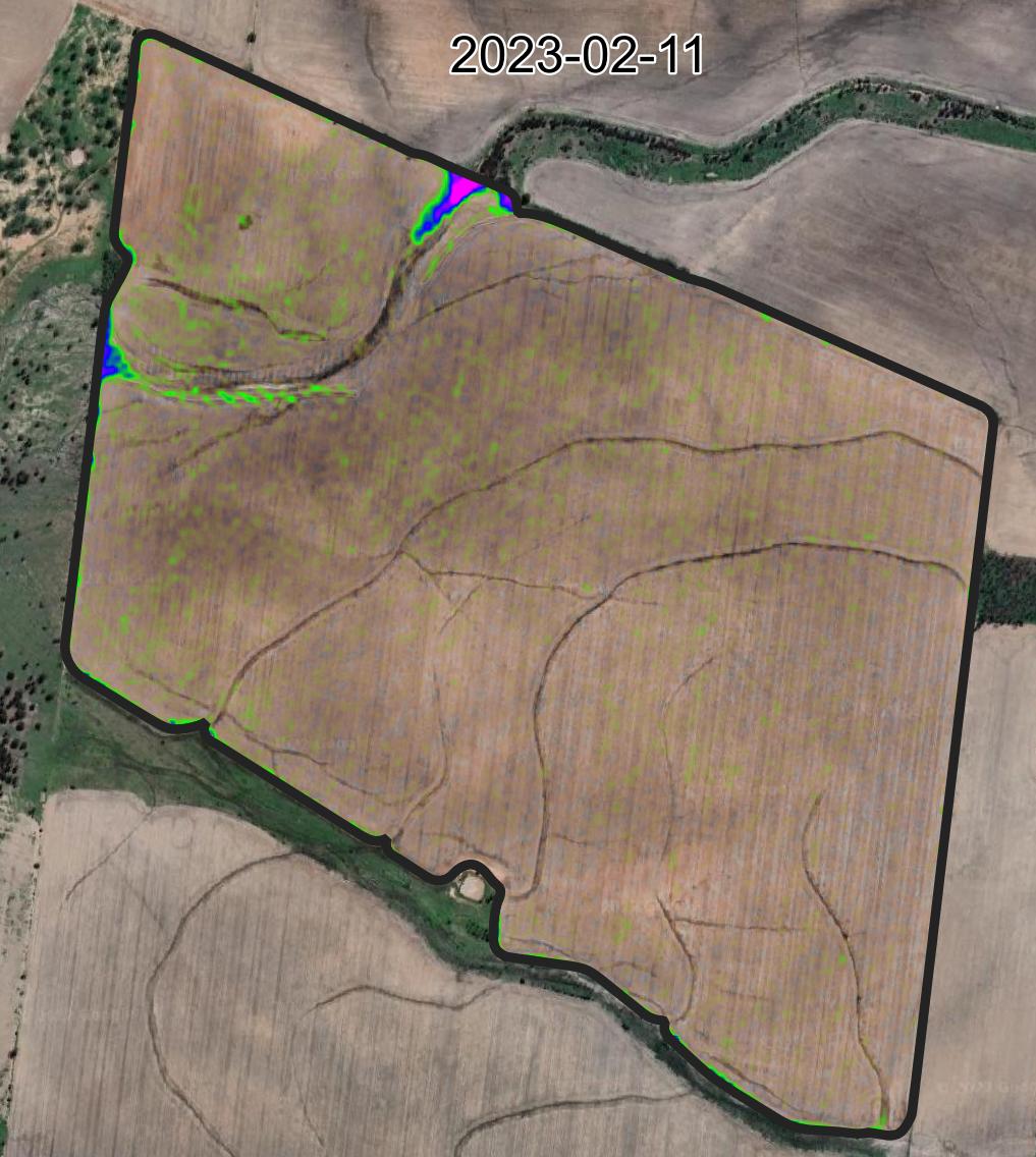
The Weedit sprayer made another pass to tidy up the remaining weeds, resulting in a clean paddock in the latest image (2023-02-11).
Finishing Notes
Detecting weeds in fallows using satellite imagery is challenging. Therefore, the color scale is set to be quite sensitive, which may introduce some noise or misinterpretations, such as brighter soils or residues being perceived as weeds.
I recommend using imagery for weed monitoring as an overview or an insurance measure rather than a primary tool for directing sprays or inspections. Waiting until weeds are visible in satellite imagery before ground verification could lead to problems. However, noticing green areas on imagery can highlight high-priority areas for closer inspection.